|
Utah, May and June, 2005 photos by Alan Grinberg Click on the photo to see the larger version of the panorama. |
 |
|
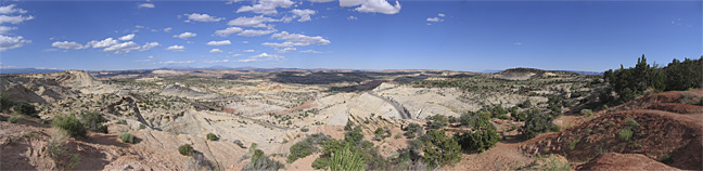
Utah Route 12 Scenic Byway, the "Million Dollar Road". Note the road that is cut through the sandstone. This is one of the world's great drives. The mountains in the far distance include Navajo Mountain (Head of the Earth), 63 miles away. |
 |
|
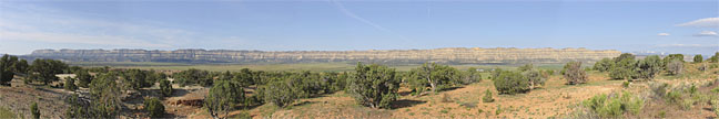
Straight Cliffs. |
 |
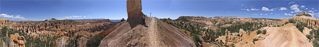
| Bryce Canyon National Park, Bryce Point June 4, 2005, 3:03 pm. Panorama is made of 15 images stitched together. Total size of final high resolution image is 70 megapixels. The linked photo is 3.6 megapixels. For another interpretation of this view see the 1 gigabyte photo taken from the same location, by Max Lyons. |
 |
| Bryce Canyon, Fairyland Loop Trail Standing in the shadows.... |
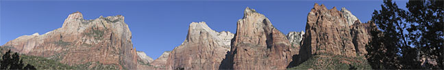 |
| Zion National Park, The 3 Patriarchs |
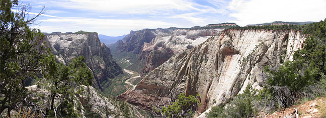 |
| Zion Canyon. Photo taken on the trail to Observation Point.
Hiked up from the valley below (2,100 feet elevation gain), Observation Point is at the top of the large white cliff on the right. This perspective shows the longest view down the valley. |
| Next Group |